World War II Maps of Service and Sacrifice

In revealing firsthand the experiences of individual soldiers, World War II maps are more than just objects of history
Courtesy of the National WWII Museum

This map was used in the Union Depot train station in El Paso, Texas, and has signatures and unit patches from soldiers who passed through. It’s now on view at the National WWII Museum in New Orleans.

On the day after Christmas, 1944, ball turret gunner Kenje Ogata found himself in the belly of a B-24 bomber under enemy fire over Hungary. Born in Gary, Indiana, in 1919, he was one of only a few people of Japanese descent serving in the US Army Air Corps. On his person, secreted away, was a silk map of Europe. He knew the map could be the difference between life and death behind enemy lines.

The attack on Pearl Harbor some three years earlier had inspired Ogata to enlist. Although he was discouraged by the draft office due to his ancestry, he persisted, stating, “I’m here to serve.”

Ogata was initially sent to Camp Grant in Rockford, Illinois, to be an Army medical corpsman. But he wanted to fly, having already earned his pilot’s license. Reassigned, he joined the 15th Air Force, 49th Bomb Wing, 451st Bomb Group, 76th Squadron, and was sent to Europe. He flew thirty-five missions from Foggia, Italy, to places including Romania, Africa, Russia, and Hungary.

Shot down that day in enemy territory, Ogata parachuted out of the faltering plane. In a later letter to his wife, he wrote, “Was the last one to bail out in the back. It never occurred to me to worry about whether the chute would work or not, cause I was scared as the devil about everything.” When his feet were on the ground, he walked twenty hours from the wreckage with his map before a Hungarian farmer helped him reunite with his crew.

Kenje Ogata Collection, Veterans History Project, American Folklife Center, Library of Congress

This silk map was carried by Kenje Ogata, who served in the US Army Air Corps during World War II, when he was shot down over Hungary on December 26, 1944.

Donated by his family, Ogata’s silk map now resides at the Library of Congress in Washington, DC, as part of the Veterans History Project in the American Folklife Center. (Ogata died in 2012 at the age of 92.) 

“A map can become a talisman,” said Megan Harris, senior reference specialist for the Veterans History Project. “It represents a source of comfort, a means of safety. It was a thing to hold on to when there was very little for a soldier to hold on to.”

Alongside the eightieth anniversary of D-Day this year, the personal stories behind World War II-era maps are being explored. Like in New Orleans at the National WWII Museum, where there’s a large world map on display in the newly renovated Forbes Rare and Iconic Artifact Gallery. It was used by Maude Stevenson, executive secretary of the Travelers Aid Society at Union Depot in El Paso, Texas. It was pinned in her office, and as she assisted military personnel traveling through the train station, she asked them to sign the map and write their predictions on when the war would end. These ranged from the optimistic (“tomorrow”) to dates projected years into the future. Hundreds signed it, including celebrities like bandleader Kay Kyser and Red Skelton. She framed it with nearly 350 unit patches given to her by those she aided. 

Assistant Textile Conservator Stella Gardner
1/4
Photo: Stewart Attwood

Assistant Textile Conservator Stella Gardner adjusts a silk dress made from escape and evade maps used during World War II, on loan from Worthing Museum and Art Gallery and currently part of an exhibition at the National War Museum in Edinburgh, Scotland. 

Silk dress made from escape and evade maps used during World War II
2/4
Photo: Stewart Attwood

Silk dress made from escape and evade maps used during World War II, on loan from Worthing Museum and Art Gallery and currently part of an exhibition at the National War Museum in Edinburgh, Scotland (detail). 

This two-sided escape map made of silk was issued by the Ministry of Defence in the UK in 1943, showing on either side countries in Europe.
3/4
Courtesy National Museums Scotland

This two-sided escape map made of silk was issued by the Ministry of Defence in the UK in 1943, showing on either side countries in Europe.

This two-sided escape map made of silk was issued by the Ministry of Defence in the UK in 1943, showing on either side countries in Europe.
4/4
Courtesy National Museums Scotland

This two-sided escape map made of silk was issued by the Ministry of Defence in the UK in 1943, showing on either side countries in Europe.

“The maps in our collection could be considered works of art,” said Kimberly Guise, the museum’s director of curatorial affairs. “They are important research tools in tracing the journeys of those who fought a global war. They allow us to follow in their footsteps.”

At Scotland’s National War Museum in Edinburgh Castle, Maps: Memories from the Second World War, on view through January 25, 2026, examines the purpose, importance, and personal significance of these military maps.

“We wanted to highlight the essential role of those involved in gathering information and making and distributing maps; it was vital that the most up-to-date information was available when and where it was needed,” said Julie Gibb, assistant curator of science at National Museums Scotland. “A map is the most important weapon in war, and lives depend on its accuracy.”

Courtesy University at Buffalo Libraries

A World War II-era map at the University at Buffalo Libraries showing Würzburg, Germany, has Allied markings representing key military targets.

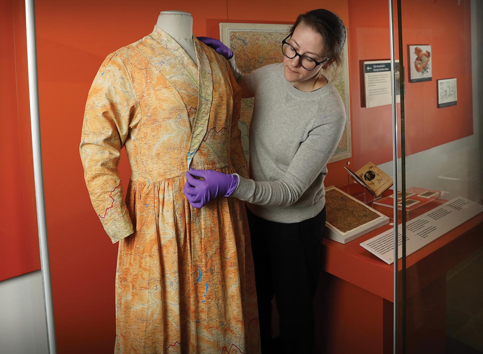
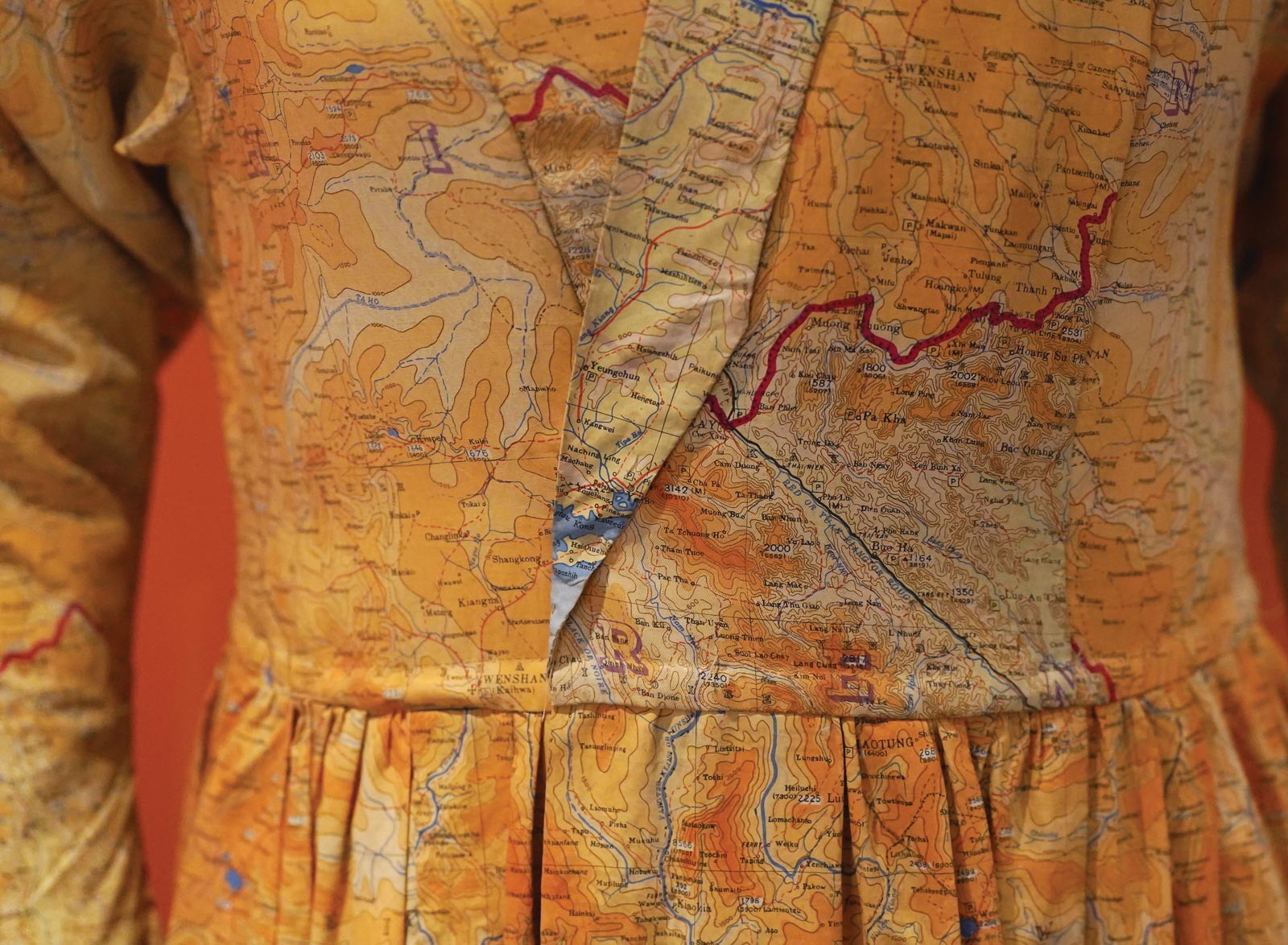
This includes the escape maps on silk, like those used by Ogata, which were pioneered by Christopher Clayton Hutton, a British MI9 army officer. MI9 was a secret department during the war tasked with assisting in the escape of Allied personnel from prisoner-of-war (POW) camps and helping Allies evade capture behind enemy lines. Hutton considered maps to be, as he put it, “the escaper’s most important accessory” that should be used by all fliers.

Why silk? Quiet to open, waterproof, and easy to hide or sew into clothing, silk maps were issued to service members and often smuggled into POW camps for use in escape in a variety of ways, such as folded inside a chess piece, hidden in a vinyl record, or laminated inside playing cards. One of the most striking pieces in the Edinburgh exhibition is a dress made after the war from silk escape and evade maps.

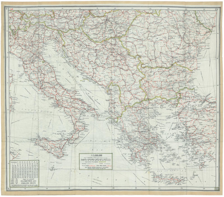
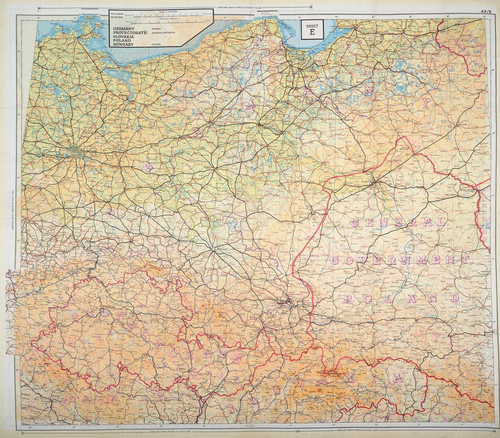
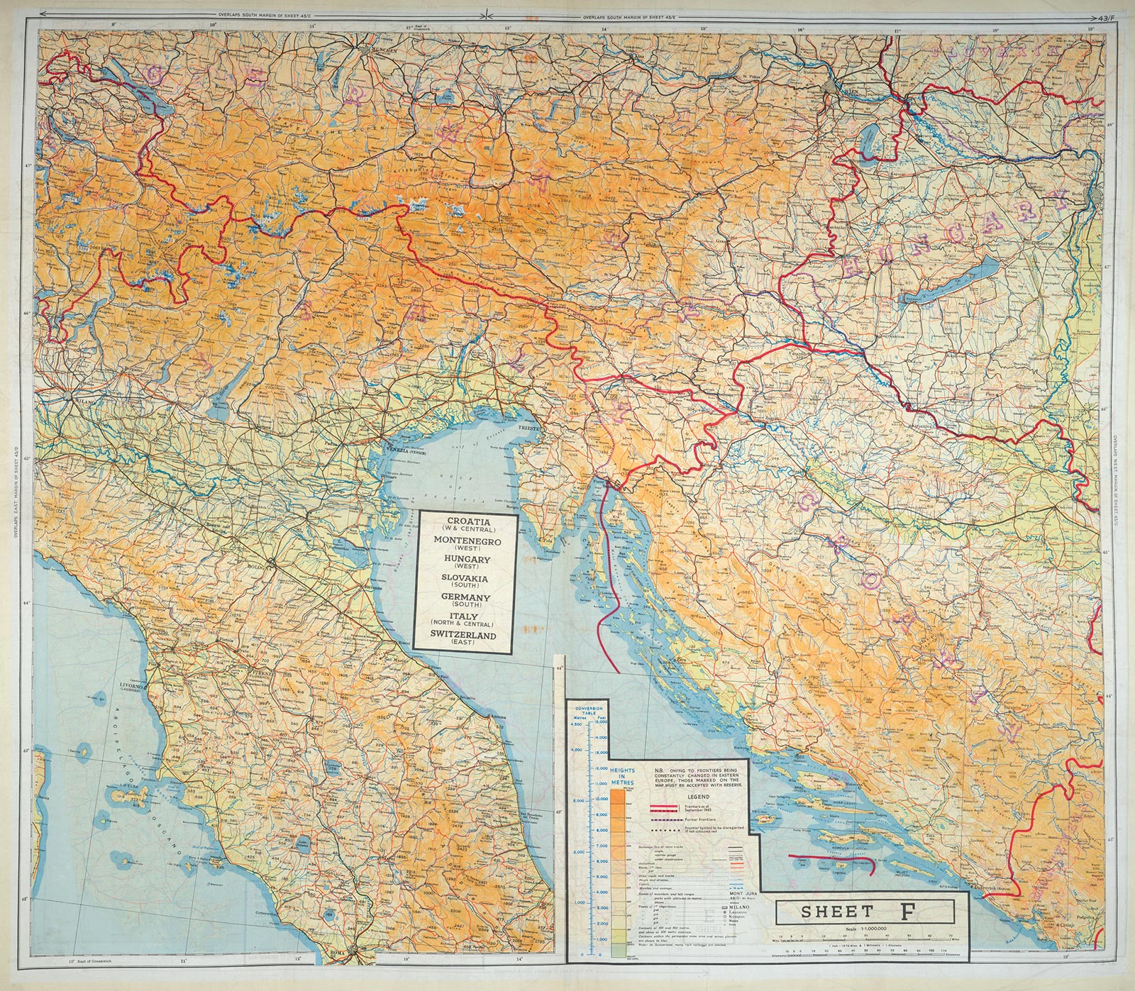
“Old maps allow us to see the shifts in our cultural values and learn from past experiences,” said Samuel Kim, a geospatial librarian at the University at Buffalo Libraries. Kim oversees 259 maps captured by the Allies during World War II, all of which were produced in Germany in the 1930s and ’40s.

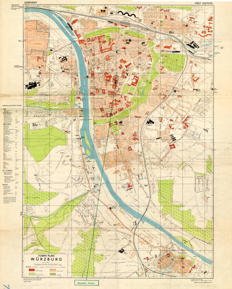
A notable map at the University at Buffalo Libraries is of Würzburg, Germany; it is one of the few in the collection with Allied markings, highlighting key military targets. Kim said of the map with a smile, “The cartographer thought wine and chocolate shops were worth labeling on the map, and we can learn something from that.”

Witnesses to History

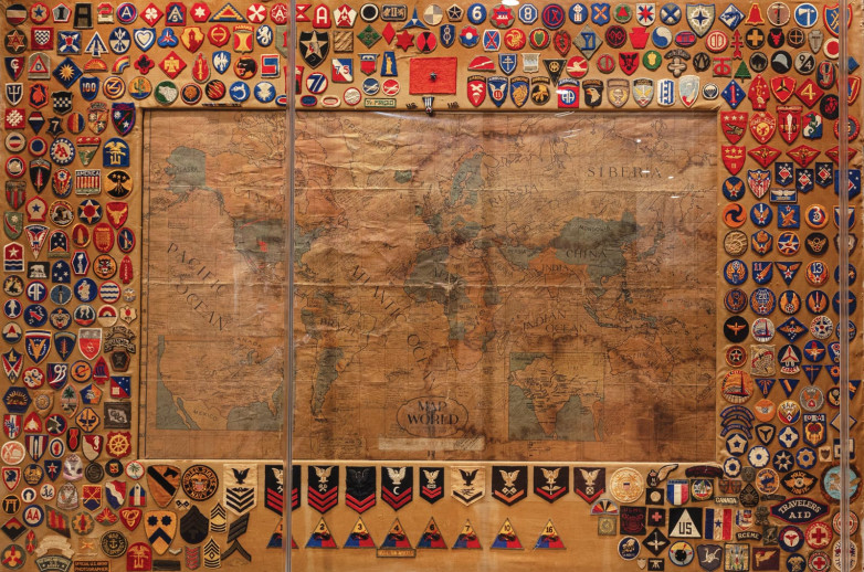
“Maps offer us a window into the past and help us understand not just a geographic perspective but also a perspective on what was considered important and meaningful to both creators and users,” said Toni M. Kiser, senior registrar and director of collections management at the National WWII Museum. “We have maps with blood stains from injuries sustained in combat and commemorative maps made by units and ships at the end of the war to show the history of it for them.”

During the war years, the British Armed Forces alone produced 342 million maps. These maps, of course, serve a historical purpose. Kim observed, “They allow us to track changes over a given area.”

But, more than that, they can now serve as a way to tell a story through cartography. “These are pivotal moments in one’s life,” Harris said. “There’s a sense of a visceral experience moving through the world. These maps represent that.”

When examining these maps, a viewer can envision Hutton perfecting an escape from his office in Buckinghamshire to be smuggled into a POW camp in Germany, Stevenson at the train station wishing the best for a soldier off to war, and Ogata walking through Hungary trying to find his way. “They saved these maps for a reason,” Harris said. “They were important to them during the war; they helped keep them alive, and they chose to keep them long after their service ended.”

The maps they clutched in their hands led them on, and they still lead us today to a greater understanding of who they were and what they went through. Approximately sixteen million Americans served in World War II. Only around 120,000 are still alive today. These maps are a way to continue to tell their stories and offer insights into their courageous lives.