Early New York City Guidebooks and Maps Go on Show at Grolier
Grolier Club
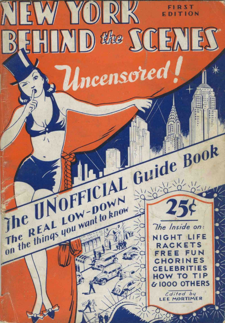
Lee Mortimer, ed. New York Behind the Scenes. First Edition. New York: Ajax Publishing Co, 1939. From the Collection of Mark D. Tomasko.
A new exhibition at the Grolier Club opening next week explores how a growing New York City was portrayed for visitors and residents.
On view in the Club’s second floor gallery from March 6 through May 10, Wish You Were Here: Guidebooks, Viewbooks, Photobooks, and Maps of New York City, 1807-1940 features guidebooks, viewbooks, photobooks, maps, and pamphlets curated by Grolier Club member Mark D. Tomasko from his collection.
On show will be some of the earliest guidebooks tracing the growth of the city, street panoramas showing buildings in detail, and photobooks capturing notable moments in the history of the city.
Wish You Were Here showcases early guides including Dr. Samuel Latham Mitchill’s Picture of New York (1807), considered the first guide to New York City, which covers topography, commercial activity, municipal government and regulations, benevolent organizations, literary institutions, and amusements. Its only illustration is an intaglio-engraved map with some inventive street layouts and a shoreline that does not match the actual island.
The exhibition also spotlights the work of publisher Moses King (1853-1909) whose King’s Handbook of New York City first published in 1892 is one of the most comprehensive single volumes on the city in the 19th century. His later King’s Views of New York, luxurious volumes with decorated cloth covers and heavyweight paper, were the ultimate in New York viewbooks. On display are many King’s publications, including a 1908 title page drawing of King’s Dream of New York featuring THE COSMOPOLIS OF THE FUTURE with airships filling the sky over the city.
1/3
Grolier Club
King’s Views of New York. New York: Manhattan Post Card Co., [1926]. From the Collection of Mark D. Tomasko.
2/3
Grolier Club
E. Idell Zeisloft, Ed. The New Metropolis. New York: D. Appleton & Company, [1899]. Autograph Memorial Edition De Luxe; No. LXXXII of 250 copies printed for Mrs. S. N. Benjamin. From the Collection of Mark D. Tomasko.
3/3
Grolier Club
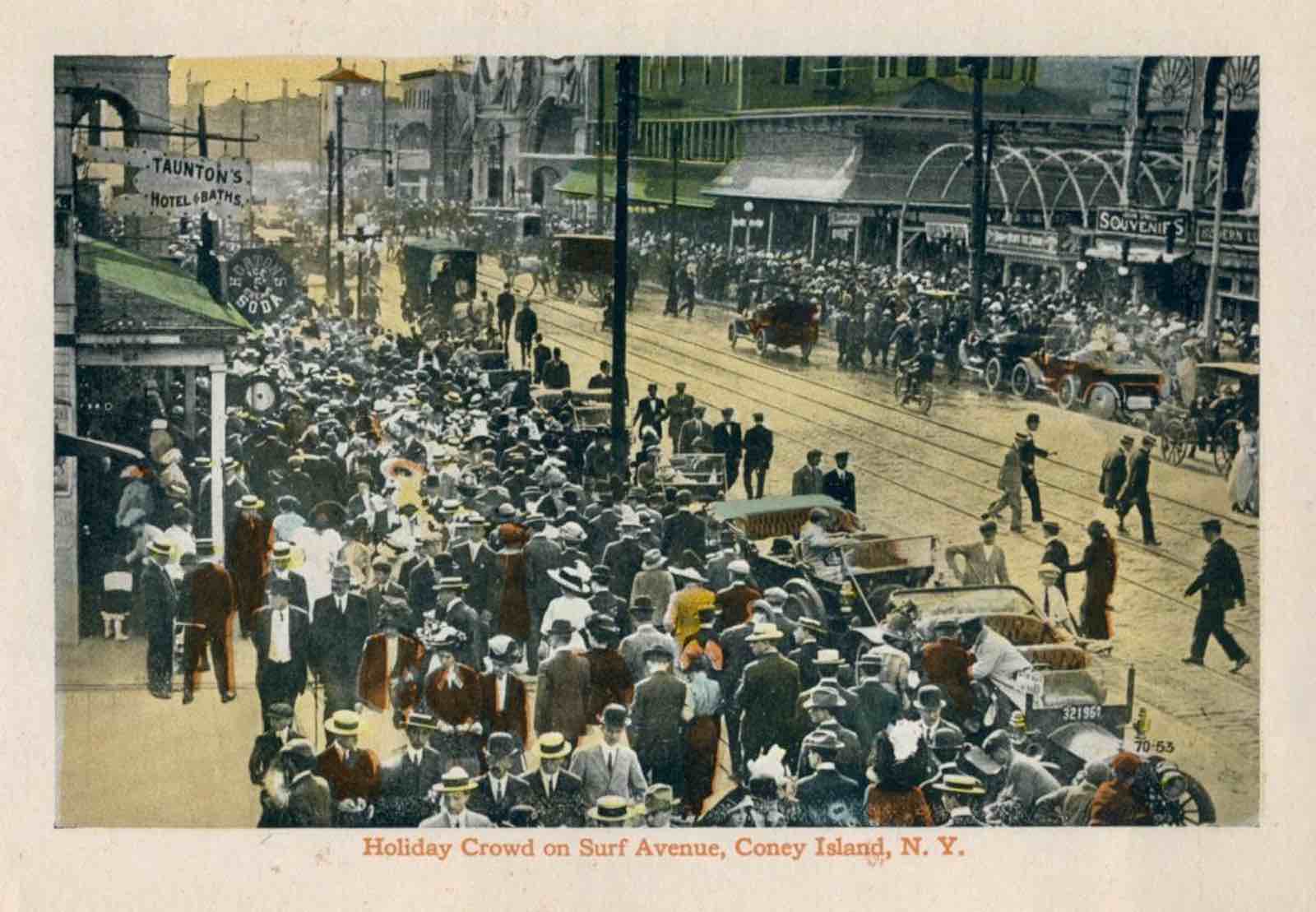
Souvenir Views of Coney Island, New York. New York and Brooklyn: Sackett & Wilhelms Corporation, n.d. From the Collection of Mark D. Tomasko.
Panoramas offer a view of everything on a street or avenue, capturing a moment in time in an ever-changing city. Fifth Avenue in 1911 was a street in transition, still predominantly townhouses north of the 50s, but empty lots and apartment buildings were starting to appear. Welles & Co.’s rare street panorama Fifth Avenue New York from Start to Finish (1911) features landscape-view images of buildings all along Fifth Avenue.
The exhibition also features examples of specialized guides to new and evolving parts of the city including:
Pictorial Bronx (c. 1920s), a promotional publication featuring a photograph of Col. Jacob Rupert and his original Yankee Stadium, and Souvenir Views of Coney Island (c. 1910), an early example of color illustration
Where and How to Dine in New York (1903), possibly the first guide to New York restaurants
Pocket Map and Visitor’s Guide to Central Park (1859), which describes the newly-opened area of the Ramble but nothing else, as so little of the park had been finished
The Chrysler Building (1930), a souvenir brochure with a silver-embossed image of the building on a black velvet cover
Maps from Tomasko’s collection on display include Viele’s Topographical map of the city of New York showing original water courses and made land (1865), one of very few 19th-century maps of the City that is still used today, as construction contractors reference it for underground streams, a crucial piece of information for building foundations in Manhattan.


![King’s Views of New York. New York: Manhattan Post Card Co., [1926]. From the Collection of Mark D. Tomasko.](/sites/default/files/media-images/2025-02/grolier1.jpg)
![E. Idell Zeisloft, Ed. The New Metropolis. New York: D. Appleton & Company, [1899]. Autograph Memorial Edition De Luxe; No. LXXXII of 250 copies printed for Mrs. S. N. Benjamin. From the Collection of Mark D. Tomasko.](/sites/default/files/media-images/2025-02/grolier2.jpg)